
From collection COA Rob Finn Papers

Page 1
Search
results in pages
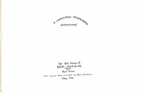
A Windshield Neighborhood Inventory for the Town of Bar Harbor
WINDSHIELD
INVENTORY
for the Town of
BAR HARB OR
by
Rob Finn
with digital data provided by Kurt Jacobsen
May 1992
GULF
of
UEBEC
SALTSBURY
LOVE
PRINCE
QUEBEC
NB
EDEN
FREDERKTON.
SAINT JOHN!
45
HULLS
MALNE
COVE
BANGOR
HALIFAX
MONTPELLER
AUGUSTA
M
3
VT
NH
June GULP
YARHOUTH
PORTLAND
Maine
BAR
©CONCORD
HARBOR
the winshield neighborhood
inventory
begins
here
Mass.
BOSTON
HARTFORD.
Providence
Comm.
TOWN
HILL
POINT
102
LAKE
ROAD
8
THE EAGLE
Aba
ACADIA
NATIONAL
BAR
PARK
3
the town of
BAR HARBOR
MAINE
OFTERS
MOUNT
CREEK
DESERT
ISLAND
-
PA4
1
1/2
0
1 mile
2
3
CONTENTS:
ndshield Neighbor hood Inventory is a
A
WINDSHIELD NEIGHBORHOOD INVENTORY
trip through the different sections of
BAR HARBOR
2
E It is designed to be a study of the
Cottage Street
3
Water front Area
5
acter in an effort to better understand
Village Green and Mount Desert Street
7
8
, for future development.
Upper Main Street
aracters of the different areas are
the Perimeter of the Village
9
Route 3, Eden Street and Route 233,
inected to the scenic vistas within
the Eagle Lake Road
10
se refer to the Scenic Inventory
"SUMMARY
111
South of Bar Harbor on Rate 3
12
d of this book to more Fully under-
ROUTE 3
13
eir importance.
Hulls love
14
16
Salisbury Love
18
Eden
19
Northeast Creek Access
20
Head of the Island
'SUMMARY
20
ROUTE 102
22
TownHill
23
Indian Point Knox Road and the
25
Gilbert Farm Road
"SUMMARY
20
THE INTERIOR OF TOWN
27
the Crooked Road
27
30
Norway Drive
32
Route 233
33
Afterword: Possible Futures
D SUMMARY
320
I
Appendix: Scenic Inventory
45
AR HARBOR
photo 1
In attempting to understand the character
and unique in Maine, a wild West style.
with intricate Facades and Gold Rush type
of the village of Bar Harber, one must take many
architectural and site planning styles into consid-
signage.
evation. Some examples of building styles include
Victorian Era, Georgian and Federal Er , several Tudor
style with exposed beams and stucco, and most pecular
photo. 1
DOWNTOWN BAR HARBOR, the hub of the town's economy.
standards are integral in retaining the well-orchestrated
The area's attractiveness is based on the views down each
environment which benefits all businesses here, as well
of the streets and the peculiar conglomoration of architect-
as the town as a whole. Together all these Facets of
ural styles which have accumulated over the years. Visibility
the down town character make a sort of "vacation land"
and openness are retained by the submergence of the
atmosphere were visitors are happy to leisurely roam about
tele phone wires. The Central Business District's Design
From here we will travel to the different areas
of the village
BAR HARBOR
photo 2
photo 3
photo
COTTAGE STREET
travelling west
The area of the Post office. This is
Looking across the street, you see the
the end of the downtown Business Dist
Critereon Theater and the Mayfair Mall. also
Looking back east at the intersection
Known as the oddfellows Hall, signifi cant
of Cottage and Main.
rict and the heavy foot traffic
to Bar Harbor history because it was the
seat of government From 1894 until the 1960's
photo 6
photo 5
IIIII
Farther west, you have houses with businesses in them on
Travelling Farther West down Cottage just
lots with yards. Across the street on the left is a gas station with
past the Post office. you come to Rodick
an entirely asphalt lot.
House which recalls the cottage Industry
of Maine. note the yard. Across the street
on the left are two Franchise outlets.
BAR HARBOR
photo 7
photo. 8
VL
re COTTAGE STREET
After passing through 2 stretch
You come to another group of buildings
You then come to two of the most important and heavily
more businesses in house structures
that create a "downtown" atmosphere
trafficked buildings in town, the super market and the Municipal
because of their close grouping.
Building
photo.9
photo.10
F
Just past those buildings is the corner of Cottage St.
lot with grass and trees.
The end of Cottage ST. is another
and Holland Ave. Three of the Four corner lots here have
For more discussion of this corner see the
"downtown" style of grouping and archi-
tecture. There is little fost traffic
no curb and are entirely asphalt. The fourth is a vacant
After word of this book.
here.
BAR HARBOR
photo
photo ll
I
WATER FRONT AREA
The departure point for this
area being the First photo. the
corner of cottage and Main.
Travelling North down Main St., you
enter the most heavily travelled section
of town. With thriving businesses on the
left
photo.12
and Agamont Park to the right.
ST AREA
The Town Pier is another premier
late west which is blocked by the long. Flat
attraction of Downtown with it's tour boat
hotel.
access and excellent view of surrounding
lands. except the coast to the immed-
photo. 14
photo. 15
Travelling west up West St. you come
Up to the Bar Harbor Historic Dist-
to several more thriving businesses.
rict, where most houses are "mansions"
Traffic is light and the whole street is
lined with trees.
BAR HARBOR
photo .16
Travelling South up Main St
from the departure point of the
CO rmer of cottage and Main...
VILLAGE GREEN and
MOUNT DESERT STREET
You come to the Village Green, integral to the open feeling of
Downtown Bar Harbor. All of the buildings surrounding the green still
retain the character of the Cental Business District even though they
are outside it's jurisdiction.
photo 5
photo.18
Just on the other side of the town
Farther west up Mount Desert St. are
green, going west down Mount Desert St.
many Hotels, churchos the YMCA YWCA and
the Library. Most oF this Street is lined
with beautiful and unique structures, an
excellent entrance to the village For the
many visitors who come in on Route 3.
b
BAR HARBOR
photo.19
e
photo.20
photo 21
UPPER MAIN STREET
travelling south from
the Village Green.
This area retains much of the
some Western style
and more businesses in houses.
character associated with cottage ind-
ustry..
photo. 22
The Athletic Field offers a wide open view
of the surrounding hills and mountains.
BAR HARBOR
photo. 23
photo 23
photo25
THE is
the PERIMETER of
the VILLAGE
after the Athletic Field, turning
west on Cromwell Harbor Road.
you climb a hill and have Mount air view Cemetery and its beautiful
passing the end of Ledgelawn Avenue
views of the surrounding mountains.
and the Sewer plant
photo.z4
photo.25
Cromwell Harbor Road is a
quiet option for those who
know it as 2 way of avoiding
busy downtown summer traffic.
The golf course, has equally vast views
After crossing the Eagle Lake
of the mountains and hills. This view,
Road and going down Cleftstone
you can see the most visible house
to the east reveals houses a top Straw-
in Bar Harbar visible From the entirety
berry Hill.
of Mount Desert Street. much of Cottage.
and From as far as the Tarn.
is modelled after away It
in with most of the rest of the town.
a Greek Temple not Fitting
BAR HARBOR
photo 26
photo 29
photo 29
7
(This photo did not come out.)
(This photo did not come out.)
photo 30
photo 31
ROUTE 3. EDEN STREET
and
ROUTE 233,
L
J
L
the EAGLE LAKE ROAD
This stretch of Eden Street is
The north side of Eden Street from
on Eden Street after the intersection
almost entirely large hotels, from the
the point of the previous photo to West
with West Street, on the right you have 2
Cleftstone Road brings you to
Stream crossing to the west (just off the
Street, is not hotels but rather the college
stream and wooded area which wraps around
Route 3 known as Edin Street,
inset map) to the inter section with
and is lined with deep woods.
the school on the hill and continues to
which is the entrance to the
West Street
the inter section with Route 233. On the
village of Bar Harbor for most
left you have homes and the often backed
visitors.
up entrance to Cottage Street.
photo. 29
photo.30
photo 31
7
( This photo did not come out.)
L
The intersection of Eden Street,
Route 233 (to the right) and Mount
Up Route 233 you have two large
there are neighbor hoods on
structures on the right and wooded
both sides of the street . and the
Desert Street (to the left).
Frontage to the left (just out of this
golf course in the valley. The rest
frame). over the hill
of Route 233 will be discussed on page 32.
BAR HARBOR
SUMMARY OF CHARACTERISTICS
In the same order as the
photographic essay.
e. same as b. and
h.
heavy and fast
c. low foot and ve-
vehicular traffic
a.
heavy foot traffic
homes to the
nicular traffic
closely-grouped buildings
eastern side of
almost no foot
large old houses
traffic
architectural facades
the street
lawns with trees
heavily wooded
bright colors
Bed and Breakfasts
a
f. hervily wooded
with driveways
well-built sidewalks
to homes on the
ST.
extra-heavy but slow
d.
moderate foot
g.
low but Fast
h.
shore
vehicular traffic
traffic
e.
vehicular traffic
entirely commercial
heavy and slow
sparsely populated
i.
almost all of the
few modern buildings
vehicular traffic
views of mountains
remainder of
b.
moderate foot traffic
large. widely-
the village is
spaced buildings
.some closely. grouped
heavy and fast
residential with
well-built side-
walks
i.
g.
vehicular traffic
homes with yards
buildings
lawns with
almost no foot
and trees
.some widely-spaced
occasional
£
traffic
almost no "eyper.
buildings
extra heavy but slow
trees
RD,
almost entirely
imental" or mod-
ern architecture
vehicular traffic
mostly old
large modern
MOS tly commescial
buildings
hotels
some modern buildings
121
photo. 32
SOUTH OF BAR HARBOR
ON ROUTE 3
Leaving the village of Bar
Harbor, travelling south, you
pass through a residential
area with Fairly thick woods
on both sides.
photo 32
photo 33
You come to the ocean Drive
junction to the left
photo. 33
photo. 34
and Further on to Jackson Labs.
OTTER CREEK. This shot, tooking
After travelling through the Park for
north, shows the residential atmo.
a while you come to...
sphere surrounded by mountains.
OTHER
photo 3th
ROUTE 3
is
SALISBURY
COVE
ROUTE 3
EVEN
photo 35
TRENTON
Bo
HARBOR
De
Rouse's
TOWN
SHILL
B
3
For 2 more in-depth study of this
study done by the Land-Use Planning
Heading west out of Bar Harbor after crossing the
road see the "Route 3 corridor
class of 1991 at college of the Atlantic.
stream that marks the end of the hotel area, you pass
several old fashioned structures amidst large White
Pines an the right.
photo. 35
Then you come to the BluFFS, certainly one of
the most spectacular views in town.
After the Bluffs , there are more buildings
surrounded by White Pines. before Hulls Cove
HULLS COVE
14
photo
36
photo. 37
N
photo 40
photo 39
photo 38 37
photo
photo36
This view is from the intersection of Route3 and the
and see almost the whole village
Crooked Road (just out of the Frame to the right.) looking south.
of Hulls love with neighborhoods all
For further discussion of this corner see the
After passing the entrance to Acadia
around the stores restaurant and notels
Afterword of this book.
National Park you road the curve
along Route 3.
photo. 38
photo.39
photo. 40
From the same point as the previous photo ( the Crooked
Road is just out of the frame to the left) but now looking
Continuing north through Hulls Cove
This view From a neigborhood
north at Lookout Point and the shore.
you climb a hill. This view is looking
area further north up Route 3. but
south. back over the village and the
still looking south, . shows the
mountains.
extended view of the mountains
you have if you approach Hulls Cove
from this direction.
more
HULLS COVE
1J
photo.41
3
g
80
photo.42
All
photo.43
Just north of the cove on Route 3 is an excellent view
of Ireson Hill afforded by the open field.
4
0
R
photo
41
JEYS
DDG
photo. 42
photo 43
IRESON
HILL
a
a
aD
HULLS
LOVE
d
20
P
80
40
a
After you pass through previously mentioned residential neighbor-
These shots looking south from Route 3 show more of the
hoods, you come to Ireson Hill. which has no houses on it. It could
mountain views of the area.
be described as having a tourist oriented commercial character . com-
It is important to remember that these views of distant mantains
parable to the area of hotels at the entrance to the village of
are Far more visible than can be captured in photographs. A viewer
Bar Harbor.
moving in 2 car sees through the trees and houses that pass by
The Sand Point Road to the north oF Ireson Hill is almost en-
quickly and get a constant view oF the mountains for several hundred yards. tirely residen tial except For a small collection of motor court
lodging on the north western shore.
SALISBURY COVE and HAMILTON POND
16
photo 44
photo 45
photo 46
photo47
SALISBURY
44
photo.45
plato.4u
Continuing west down Ireson Hill you
get an extended view of the hills to
Hamilton Pond to the left
and Salis bury cove to the right.
the west as you gradually descend
to...
photo 47
OK
The middle of Salisbury cove.
more SALISBURY LOVE
I7
photo. 48
SALISBUR
COVS
THE
At the western end of the village there are several historic structures. This photo looking east.
photo 49
Looking you get an excellent view of Hamilton Pond and the mountains.
EDEN
photo 50
IU
This shot is looking east. Visible
to the left is the mainland and in
the center the distant Ireson Hill.
SALISBURY
COVE
photo 50
photo 51/nettpage)
The residential area of Eden is typically
houses with open yards along Rotte 3 and
secluded houses near the shore.
Leaving Salisbury love. continuing down Route 3 to the
west you climb the hill of the village of Eden. You
travel through wooded stretchs with several homes.
Notable is the historic Hamilton Station barns on the
right. and several open Fields on top of the hill.
NORTHEAST CREEK ACCESS
photo.31
photo.52
photo.53
and.54
This area is to be
Descending the hill you get views of the mountains
As you descend the hill
noted because of its
high traffic and its
to the southeast over an open field with very old farm houses.
public canoeing access.
photo. 52
photo.53
photo. 54
At the bottom of the hill you have views to the south-
you get an extended view of the
east of Nor theast Creek and the distant mountains
and to the north west of the
hills to the south and an old farm
creeks outlet , 1 2 few islands and
house and barn in a field.
the mainland.
HEAD OF THE ISLAND
ZO
SECURITY
1
a. Climbing the hill past North east
b. The next section of Route 3
C. The Head of the island the First
Creek you pass more homes among
is a fairly tourist oriented
impression of Bar Harbor for most
trees and Fields. The intersection
commercial area augmented
visitors, is heavily wooded with
of Route 3 and the Knox Road is
by views of the bay and
a few commer cial establishments.
so sharp that it can be assumed
the marshes.
that it was laid out by cows,
not engineers.
ROUTE 3
SUMMARY OF CHARACTERISTICS
In the same order as the
photographic essay.
j
SALISBURY
ROUTE 3
COVE
The traffic through.at Route
f.
d.
3 is heavy in the summer and
EDEN
H.
HULLS
moderate in the off.season. Speed
LOVE
is around forty miles-per-hour
unless otherwise noted. Foot traffic
TRENTON
a:
is non-existant unless noted
g.
8
BAR HARBOR
n.
TOWN
HILL
B
33
e. many widely spaced
g.
open yards
j.
the rest of the Route
a. . heavily wooded
C. mostly homes with
homes
houses
3 corridor is heavily
semi secluded buildings
yards and trees
occasional motel and
1 motor court
forests
wooded with occasional
secluded homes
b.
some buildings close
civic buildings
historic buildings
creek access
views of mountains
moderate foot traffic
to street
in Salisbury Cove
h. partially wooded
many businesses in
house-like structures
d.
almost entirely hotels,
motels and camp.
motor - courts and
motels and camp
f. open yards
ground
motels
ground
homes
few trees
partially wooded
motor courts
1.
heavily wooded
low foot traffic
many large signs
very fast traffic
occasional businesses
very fast traffic
ROUTE 102
LL
photo. 55
photo.55
photo. 56
ROUTE NZ
Red Rock corner could be described as
the indusTrial supply area of town.
For a more thorough study of this area
ditions and development possibilities, see Optians for
and all of Town Hill, including ecologica ( con.
the Future by the University of Pennsylvania Department
of Landscape Architecture and Regional Planning published in
For close to smile, the
May of 1991.
road is heavily wooded
on both sides.
photo. 56
6
Notable here at the corner proper are the public access
From the beginning of the ascent up Town Hill just
to Western Bay at Clarks Cove to the right and view of the
about where the two cars are passing in this picture
Northern side of Town Hill in the back ground.
TOWN HILL
a
photo. 57
BLOOD
%
photo.57
photo.58
a
CLARK
COVE
photo.
UP
of
TOWN
HILL
you enter the tourist-oriented commer cial area of Town
D
Hill.
photo 58
photo. 59
AG
Farther up the hill you pass through
To the north more looking back
what could be described as the
down the hill. you get an extended
cottage industry area with stores in
view of the hills and mainland in
house-like structures almost all with
the distance.
yards and trees in front.
photo 60
photo-lob
photolog
TOWN
At the top of the hill. you come
As you turn the distinctively country
to what could be seen as the center
road-style sharp turn to the right
of Town Hill.
photo. 61
photo. 62
you dramatically encounter a view
At this point you can even see Somes Sound.
of the distant mountains which lasts
This entire area from the top of the hill all the way to
for nearly half a mile.
Somesville is residential with Fields, thick woods and a
For more discussion of this view see the After-
cemetary.
word of this book.
INDIAN POINT, THE KNOX ROAD and GILBERT FARM ROAD
ZS
photo 63
Turning down the Indian Point Road
from Town Hill , you are on one of the
roads seldom travelled by the casual
island visitor. It is heavilly wooded
in its entirety and sparsely populated.
Notable are the public park on
Indian Point and the views of the
mountains to the east from the
intersection with the road to oak
Hill. ( pictured here).
The Knox Road and Gilbert Farm Road
area of town is almost completely residential.
Homes are typically on one acre plots with
lots of trees and yards.
photo 63
WESTERN SIDE OF TOWN
SUMMARY OF CHARACTERISTICS
In the same order as the
photographic essay.
is
FARM RD
£
!
.
Traffic is Fast and Foot traffic is
Route a.
loz
non-exist int unless noted.
e.
INDIAN
SOMES
VILLE
a. heavily wooded
C. . partially wooded
e. . heavily wooded
.
rare homes
occasional homes
cottage industry store-
and businesses
in -home commercial
businesses
f. . heavily populated
b. sparsly wooded
yards
homes with yards
warehouse style
and trees
commercial buil
d. Fields .
slower traffic
dings
woods
homes with yards
widely spaced homes
low Foot traffic
THE CROOKED ROAD
photo 64
ROAD
photo los
TOWN
HILL
102
This view looking east just after
As the geographic core of the town, this area is the most rural and sparsely populated.
leaving Town Hill is of hills and
mountains across an open Field.
photo. 65
After passing through heavily wooded areas
at the marsh of Northeast creek with views
with few houses, you come to the bird sanctuary
of the surrounding hills.
more CROOKED ROAD
40 -
photo.66
photo
photo.65
After a stretch of road through
wooded residential areas, you come to
Farm Fields on the hill to the right
which are part of
East
South
West
photo.67
The crossroads of the Crooked Road
which reachs up Norway Drive to the north
to the south and several historic
and Norway Drive. This collection of farms
and south, also has d stream. wooded hilltops
farm houses and barns.
more CROOKED ROAD
OF
and
80
o
HULLS
COVE
0/07
e.
o
5
c.
X
The road continues through:
a. homes amid fields and b. an old Farm (discussed c. 2 working farm d. a stretch of e.
and ends as
forests.
with mountains
woods with
you pass through
further in the After-
word of this book.)
behind.
the entrance
the quarry and
to a park
enter Hulls love.
lake.
NORWAY DRIVE
30,
photo. 68
vast Farm Fields visible From the
can see houses forests hills and even Blue Hill
top of the hill. Looking east here, you
on the mainland.
photo 69
Connecting Salisbury love and Route
233 on the southern edge of town, Norway
Drive is as centrally rural as the
This view is From Old Norway Drive
of the field between it and the
Crooked Road.
The beginning of the road crosses Hamilton
Crooked Road with a hill behind
Pond and travels through a wooded area
which opens to...
VAY DRIVE
photo .70
photo 70
Just north of the crossreads with the
have Farm houses and Fields, heavily wooded
Crooked Road (see P.28) looking south you
hills on all sides and to the right in this
picture, the main land.
photo. 71
photo
ni
After travelling through a mile and a half of heavy woods
with occasional houses you can see the mountains to the
south east for an extended period of time through the trees.
The road is wooded all the way to the junction with Route
233, the Eagle Lake Road.
ROUTE 233 the EAGLE LAKE ROAD
32,
BAR
HARDOR
to
somes
sound
After leaving Bar Harbor far to the east, you travel through the park until you come to:
a. the Eagle b. the National Park
C. some homes, a tackle
d. The rest of the road is e.
the island High
Lake access.
Head quarters with
shop and an open field
heavily wooded except for
School.
the Farthest view
all pictured below.
a Few houses, a marsh
in town west over
Visible in the background
and...
the island to the
is the hill which Norway
mainland.
Drive crosses.
photo.72
INTERIOR OF TOWN
35
SUMMARY OF CHARACTERISTICS
In the same order as the
photographic essay.
BOUTE 3
SAUSBURY
GOVE
an
ROAD
CROOKED
HOLLS
LOVE
TOWN
B
Bo.
HILL
o
SOMES
233
THE
VILLE
&
EAGLE
LAKE
2010
The entirety of the Crooked Road (until the
quarry), Norway Drive and The Eagle lake Road
(Until the golf course in the village of Bar Harbor)
is
heavily wooded
occasional open field
occasional homes. road.
side and secluded
The exceptions are areas a. and b. where
houses are close together and a few busi-
nesses.
Afterword
34
I
have painted several examples of Future
\ made these possible futures by going
over the zoning maps and Land Use Ordinances
developments which are incongruous with the
(with lots of explanation by Mr. Lock man and Mr. Sharkey )
characteristics of their neighborhoods. and in one
and comparing what I saw there with my knowledge
case. overloading the character. They are based
of the area. Hope fully. concerned residents will
on current trends of development throughout
also examine what the future has in store For
America, particulary in Maine and Bar Harbor and
their neighborhoods.
are entirely possible under current zoning regula-
tions.
These images are not intended to show that
Bar Harbor has poor zoning ; the town has many
extremely intelligent and detailed ordinances. They
are meant to show that even with the most com-
plex laws. modern development pressures can and
will alter almost every neighbor hood and district
of the town. Some times this change takes many
years of slow and subtle changes and some times
it happens abruptly with one new building.
The full color originals oF these images are
at the Office of the Town Planner of Bar Harbor.
IRVING
112
FLUE
122
Holland
1992
IRVING
REWUR
112
122
Possible
Future;
TID
38
III
x
corner of RouTe & The crooked Road
Hulls love 1992
The
crooked
Road
Hulls love
Possible
Road in the Emery District 1992
86
RFiver
Possible inthe Emery District
45
Appendix : Scenic Inventory
Is
20
B24
in
629
n
at
38.
87
83
to
82
& &
2
POLICE
SCENIC INVENTORY MAP
The views indicated Scenic on this Inventory map are Map only prepared directional visible for the from Town
generalizations. Harbor documents The the full road. extent It is of an lands acetate distinguishes overlay
of each Bar vantage accompanies point a along physical undevelopable the map of the lands town and which shows roads, boundary
which between developable tax parcels, and shoreline, winter vegetation
structures,
and topography. .
a
t
2. Town Pier - of MDI coast to the NW, Frenchman's Bay, the
SCENIC INVENTORY
islands and the Mainland surrounding. [seen in photo.1
FOR THE TOWN OF BAR HARBOR
t
3. West St. - of MDI coast, the bay, islands and mainland.
by Rob Finn
March 1992
a
4. Mount Desert St. - of hill to the west. [seen in
photo.17]
This Scenic Inventory was done for the Bar Harbor Town
5. across the athletic field - of hill with trees (house is
Planning Office in order to help them evaluate and protect the
screened)
scenic qualities which determine the towns unique character. It
is a list of all the views of land from the public roads and
to 6.
- of Strawberry Hill with
outside the immediate road corridor. It is limited to those
mountains behind.
views of or through developable lands. Additional study of the
views from the water and Acadia National Park would provide a
to 7.
"
- of hill to the NW with
complete understanding of the visual character of the town.
mountains behind.
1
8. Cromwell Harbor Road - an extended view through cemetery
METHOD
with mountains surrounding. [seen in photo.23]
In order to determine potential visibility and help with
orientation, I hand transferred all of the structures and dense
winter forest cover of the town from 1985 aerial photographs onto
t 9.
"
- of surrounding mountains through
a topographical map.
golf course.
With this map and a compass, I surveyed the public roads by
car. At every sighting of hills, trees, buildings, bodies of
water, coastlines, or mainland, I pulled over and determined what
o
10. Cleftstone - an extended view through trees and yards of
it was I was looking at. I did this by examining the map, taking
hill to the East. [seen in photo. 25]
compass readings and looking through binauculars for
distinguishing landmarks. I marked on the map my location on the
t
11.
"
- of mountains to the South through trees.
road, the farthest extent I could see side to side and the lands
that were visible.
12.
"
- of clinic on top of hill.
DATA
t
13. Route 3 - of Champlain. [sen in photo. 32]
The following is a list of descptions of each view I have
designated on the Scenic Inventory map.
t
14.
"
- of Champlain. {seen in photo.33]
It is important to remember that view points are not
actually single instances of sudden visibility. As you drive
t
15. otter Creek - of all the surrounding mountains from just
through them, they usually grow in visibility as you approach and
about everywhere in the village. [partially seen in
continue afterwards.
photo. 34]
t
designates views of distant mountains, mainland or bodies
t
16.
"
- through trees of houses in the village.
of water.
a
designates when structures are visible on hills within
t
17. Route 3 - of the bay and the mainland off the Bluffs.
the "VISIBLE LANDS".
[seen in photo.35
Descriptions should be read as, " The view is
"
18. Hulls Cove - immediately after rounding the turn, over
the whole village and road to the north with hills
behind. [seen in phot. 36]
VIEW #
1
1. Corner of Cottage and Main St. - down Cottage Street of
t
19.
"
- to the SE of cove, bay, mainland, islands
the trees around the Elementary school and Great Hill
and MDI coast. [partially seen in photo. 38]
behind. To the North are Frenchman's Bay and Bar Island.
To the South is Champlain. [seen in photo. 1]
t
20.
- over village with surrounding hills and
mountains behind. [partially seen in photo. 39]
t
21.
"
- to the east of mainland and bay.
t
40.
"
- through marsh to the northeast of coast,
islands, bay and mainland.
22. Hulls Cove - of Ireson Hill to the west.
t
41. head of the island - of mountains to the south.
t 23.
"
- an extended view to the south of mountains
through houses and trees. [partially seen in photos. 42 &
43]
t
42. Route 102 - of mountains to the south over woods.
t
24. Ireson Hill - an extended view to the west of the
43.
⑉
- of side of Twn Hill over fields and buildings
mainland and hills of the island. [partially seen in
to the southeast. [seen in photo. 55]
photo. 44]
44. Red Rock Corner - of the side of Town Hill over houses to
t
25. Sandpoint Road - to the west of mainland and bay.
the south. [seen in photo. 56]
26. Salisbury Cove - of houses through field to the north.
t
45. Clark Cove - to the southwest of cove, bay, island and
[seen in photo.46
even ocean.
1
27.
- through cove of mainland and bay.
46. Town Hill - to the west of ridgeline behind Red Rock
[partially seen in photo. 47]
Corner.
28.
- to the east of town with hills behind.
47.
"
- to the northwest of ridgeline over Red Rock
[partially seen in photo 48]
Corner. [seen in photo. 59]
29. Route 3 - of side of the hill to the west.
t
48.
- as you turn the corner of mountains to the
southeast continually panning across to the mountains to
30.
"
- to the east over Salisbury Cove (no houses
the south. [partially seen in photo. 61]
visible) . [partially seen in photo. 50]
t
49.
- of the mountains to the south and Somes
D
31.
"
- side of Ireson Hill (the two easternmost houses
Sound.
[partially seen in photo. 62]
in this area are visible).
t
50. Route 102 - of Patty Lot Hill to the south through field
t
32. Hadley Point - of Thomas Island to the southwest, bay and
and over forest.
mainland surrounding.
51. Indian Point Road - of hillside to the west.
t
33. Eden - of mountains to the southeast.
52.
- of hillside to the east.
1
34.
"
- of mountains to the southeast. [partially seen
in photo. 51]
t
53. Oak Hill Road - through fields of mountains to the east.
[seen in photo. 63]
35. Northeast Creek - an extended view of the fields by the
road corridor and the hills to the south.
t
54.
- through fields of mountains to the east.
t
36.
- of the creek outlet and Thomas Island
t
55. Indian Point Road - through fields of mountains to the
to the northwest; of hills and fields to the south; of
east.
creek woods and mountains to the southeast. [partially
seen in photos. 53 & 54]
t 56.
- of bay and mainland through
treetops on hillside down to the west.
37.
- of fields and hillside beyond to the
northeast.
t
57. Knox Road - of hill and mainland to the north.
38. Route 3, intersection with Knox Road - of top of hillside
58.
"
- of treetops on side of Town Hill to the
to the south.
south.
t
39. Route 3 - through marsh to the northwest of coast, bay
and mainland.
t
59.
"
- of mainland to the north.
48
t
80.
It
60. Gilbert Farm Road - of mountains to the east through
- of mountains to the east.
t
field.
o
81. Route 233 - of hillside to the northwest; of hillside to
61. Crooked Road - of hills and mountains to the east through
the west (houses visible on both) . [partially seen in
t
field. [seen in photo. 64]
photo. 72]
t
82.
⑉
62. Crooked Road - of treetops on side of Town Hill to the
- of the mainland and almost the entire eastern
side of the island.
west.
83.
63.
"
- of the marsh of Northeast Creek and
- of farmfield on mountainside to the west.
a
surrounding hills (there is one house barely visible in
the woods to the northeast) [seen in photo.65
VIEW NUMBERS OUT OF SEQUENCE
a
64.
"
- of hillside to the east.
84. Cromwell Harbor Road - of side of hill to the North with
neighborhood below through golf course.
65.
- of hillside to the south.
1
85. Kebo Lane - of the mainland and bay to the North.
66.
- of the marsh of Northeast Creek and
t
86.
"
- of mountains to the South.
surrounding hills.
67.
- of fields to the east with hills behind.
t
87. Route 3 - through campground of islands, mainland and bay
to the northwest.
[partially seen in photo. 66]
68.
- of fields to the south with hills behind.
to 88. Cromwell Harbor Road - of Strawberry Hill to the SE
[partially seen in photo. 67]
through the golf course. [seen in photo.24]
D
69.
- of fields to the south with hills behind.
89. Hulls Cove - of south side of Ireson Hill through field
to the west (quarry visible).
70.
- of treetops on hillside to the northeast.
t
71. Norway Drive - of fields to the south and west with hills
behind; of mainland mountains. [seen in photo. 68]
72. Old Norway Drive - of hills to the south through fields.
[seen in photo. 69]
t
73. Norway Drive - of fields and hills to the north and
west with mainland to the north. [seen in photo. 70]
t
74.
"
- of mainland to the north.
t 75.
- of mainland to the north.
t
76.
- of mountains to the east over house and
field.
77. old Norway Drive - of hills to the east through field.
t
78. Norway Drive - an extended view through trees of
mountains to the south and east. [seen in photo. 71]
t
79.
- of hillside and mountains to the northeast
through clearing.
Viewer Controls
Toggle Page Navigator
P
Toggle Hotspots
H
Toggle Readerview
V
Toggle Search Bar
S
Toggle Viewer Info
I
Toggle Metadata
M
Zoom-In
+
Zoom-Out
-
Re-Center Document
Previous Page
←
Next Page
→
A Windshield Neighborhood Inventory for the Town of Bar Harbor
A photographic trip through the different sections of Bar Harbor, designed to be a study of the town's character in an effort to better understand how to plan for future development. This unpublished book was produced for the Bar Harbor Town Planning Office in order to help them evaluate and protect the scenic qualities which determine the town's unique character.
Details
In Copyright - Educational Use Permitted

